
Are you nursing a case of cabin fever? Here is a fun way to get rid of that “Quarantine 15” while enjoying nature and the outdoors close to home.
- Story by Dena Temple, photos by Dena and John Temple 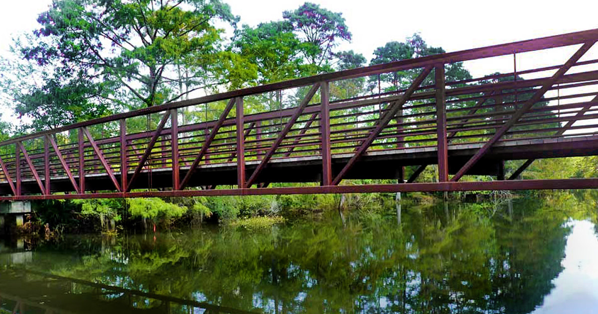
The Possum Walk Heritage Trail runs 3.7 miles between Logtown and INFINITY Science Center.
There is also the matter of, and let me be sensitive here, the shrinking clothes in the closet. Or have you completely surrendered to sweatpants and leggings?
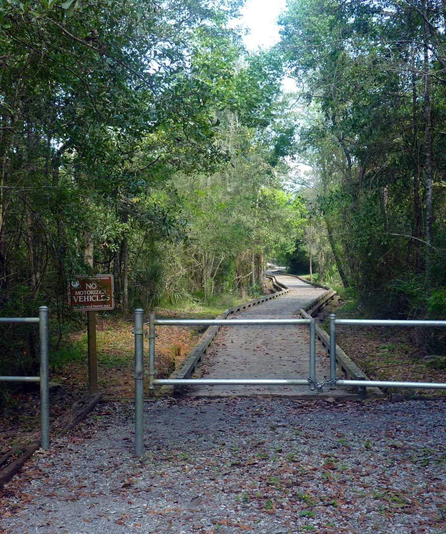
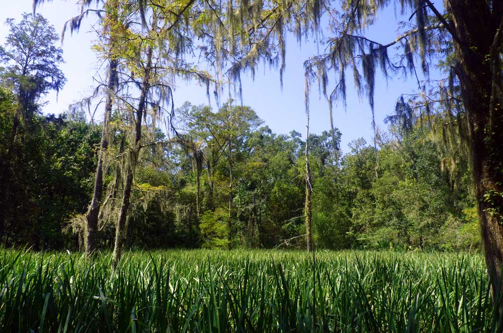
The trail head at Logtown Road, where a wide, ADA-compliant boardwalk rises above the freshwater wetlands.
This cannot continue. Isolation and lack of exercise is not only bad for your health, it’s awful for the psyche and the soul. But fear not, there is a solution, and it’s right under your nose: Get out and walk. Or more specifically, hike. The benefits of wandering in nature are many. First, hiking a trail offers fitness while social distancing. And whether you’re walking fast or slow, getting outside and moving those atrophying limbs releases endorphins that make the world feel all right again, especially when the weather turns from broil to crisp and cooler. Hiking a trail is also a great way to get to know more about the area. What is the soil like here? What type of plants and animals live here with us? What flowers bloom here in the fall? Communing with nature also engenders a sense of peace, and while the solitude of hiking is also pleasurable, hiking with a friend offers a safe way to enjoy a little much-needed camaraderie. We have some wonderful areas for hiking here in Hancock County, and a great start is the Possum Walk Heritage Trail. 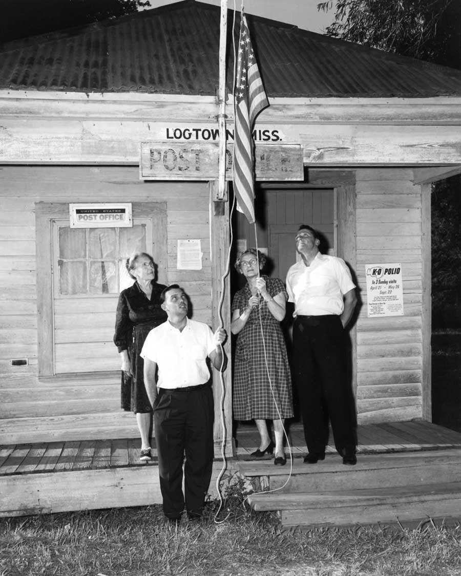
Lollie Bell Wright, Logtown Postmaster, and Roy Baxter, owner of the Post Office, lower the flag for the last time. (Image courtesy NASA archives)
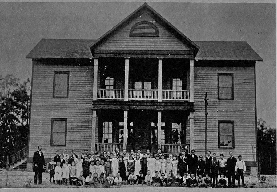
The Logtown School was located in the present location of Logtown Cemetery.
A little history In the late 1800s and early 1900s, Logtown was one of the largest lumbering centers in the United States. The sawmill employed 1,200 men, and at its peak, Logtown had approximately 3,000 residents, most associated with the lumber business. By 1930 most of the lumber supply had been exhausted. The town began a long decline once the mills closed, and by the early 1960s, only 250 residents remained. In 1961 NASA chose Hancock County for its new Stennis Space Center. Several small villages, including Logtown, existed inside the necessary acoustical buffer zone for the engine testing facility. The structures inside the buffer zone were relocated by NASA, and Logtown now exists only in history books. To read more about this fascinating chapter of Hancock County history, visit the NASA Cultural Resources website. 
Hiking the Trail, Day 1
The 3.7-mile Possum Walk Trail begins at the Logtown Cemetery and ends at INFINITY Science Center. Interpretive signage at the trail head explains not only the history of Logtown, but also how the trail got its name (it was named for an African-American settlement across the Pearl River from Logtown). The still-active cemetery includes marked graves that date back to 1853 and unmarked graves that may be even older. Since the trail does not loop, we opted to walk half the trail from each end over two days. Day One was sunny and hot, but the sun kept the skeeters at bay, and a light breeze made the walk quite comfortable. As you enter the first section of trail from Logtown Road, you find a sturdy, ADA-compliant boardwalk over marshy terrain. The lush vegetation immediately calms and silences any inner voices. After a short distance, there is a ramp to the left that leads down to an ADA-accessible kayak launch. 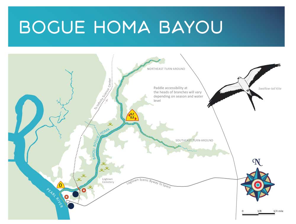
Trail map for the Bogue Homa Bayou blueways trail.
The lazy Bayou Bogue Homa
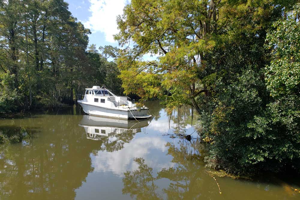
This is the Bogue Homa Bayou Trail, part of the Mississippi Gulf Coast Blueways trail system for paddlers. The easy 2.25-mile kayak trail traverses through freshwater swamp, offering great opportunities for wildlife-watching. The kayak trail is very popular and often busy on summer days. On this fall day, however, we have the Possum Walk trail to ourselves. After the kayak launch the boardwalk crosses over an iron bridge, offering camera-worthy views of the creek below. Pause a moment to watch for fish jumping, or maybe a gator lazily floating by. 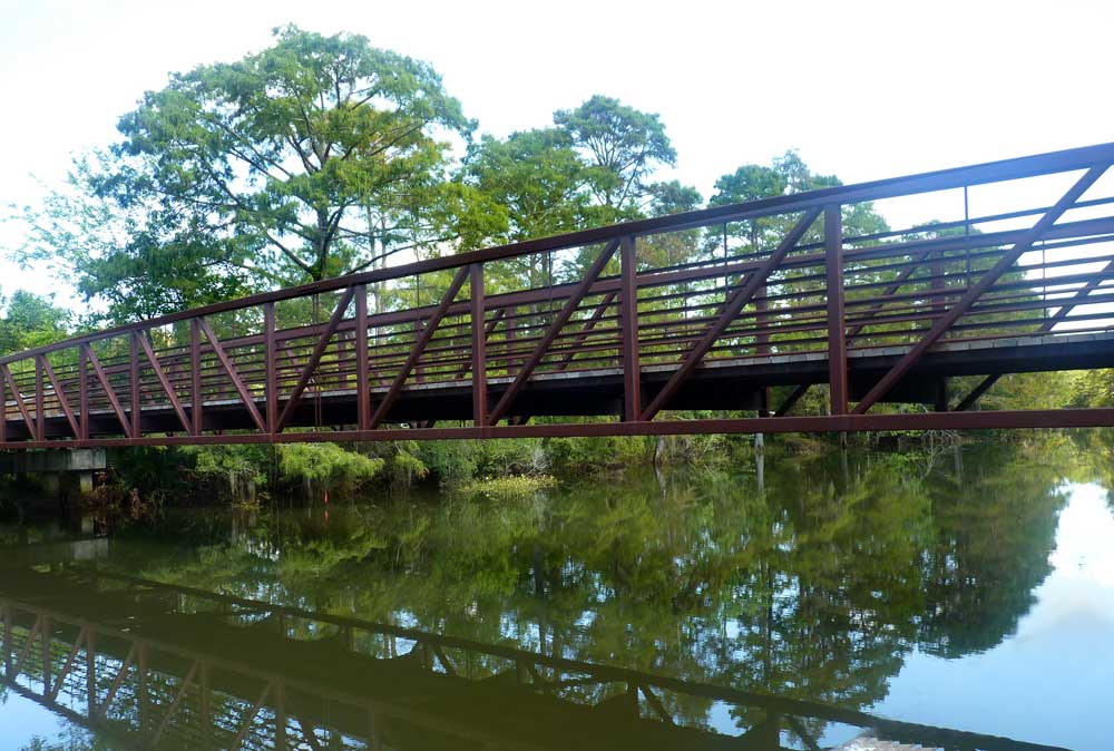
Past the bridge the boardwalk continues. Take your time and look for small animals like skinks, snakes and frogs. We found all three and also spotted a young raccoon. Periodically stop and listen: sometimes, finding wildlife is easier by ear than by eye. 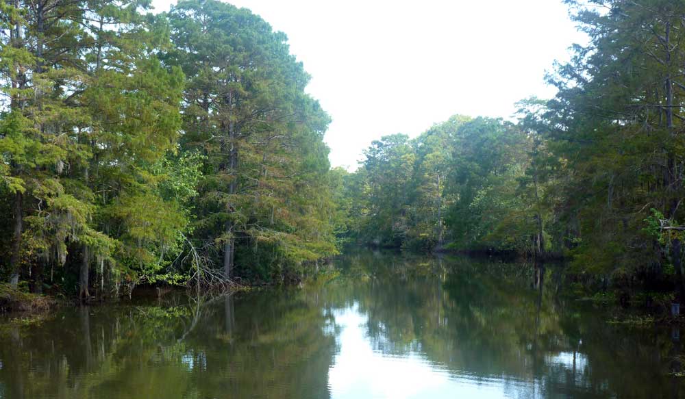
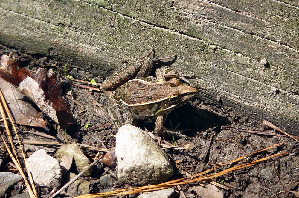
Leopard frog seen on the Possum Walk Heritage Trail.
Fall is also a great time to find birds and butterflies. While our visit revealed very few birds, every day on a trail is different; that’s what makes every trip interesting. Butterflies, on the other hand, were plentiful, attracted to the wide variety of wildflowers blooming along the trail. We also found spiders asleep in the center of their webs, waiting for an unsuspecting fly to stumble into their trap. Many are quite beautiful. 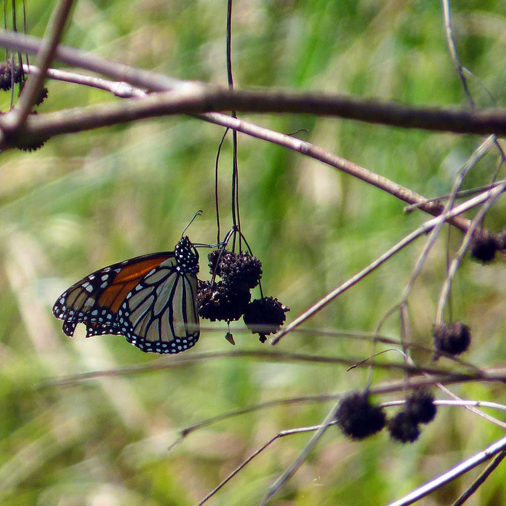
Monarch butterfly showing a little wear, resting on a cluster of sweet gum seeds.
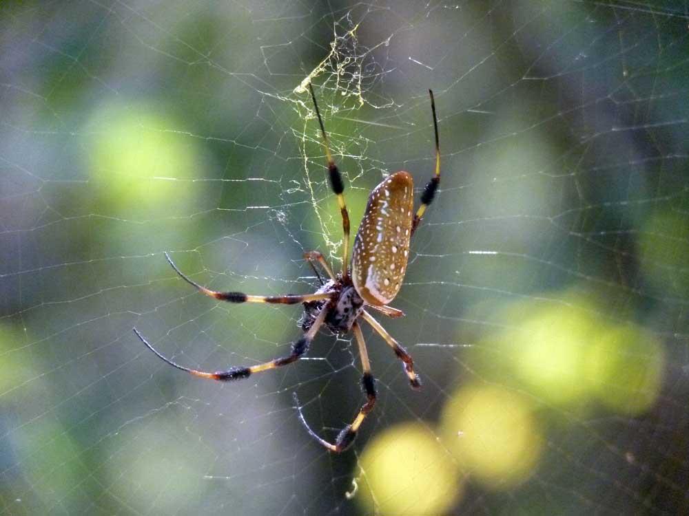
This exquisite creature is a Golden Silk Orbweaver, named for the gold tone of its silk. Females can be 3 inches across the body, not counting the legs.
Eventually the boardwalk reaches more upland habitat, and the trail becomes a wide, flat gravel path. As the habitat changes, interpretive signs along the trail highlight some of the native plants and animals that call this region home. We reached the Mile 2.0 trail marker and decided this would be a good halfway point. Tomorrow is another day. 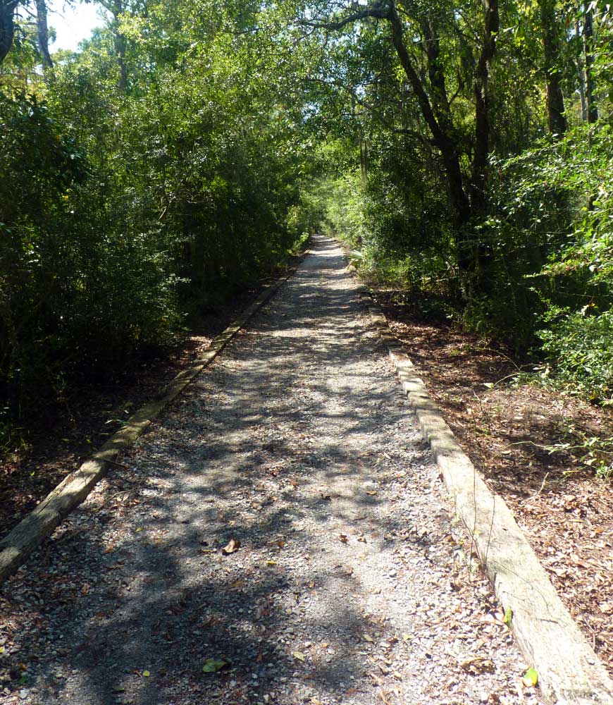
The wetland boardwalk on the Logtown side of the trail eventually gives way to a broad, well-tended gravel path.
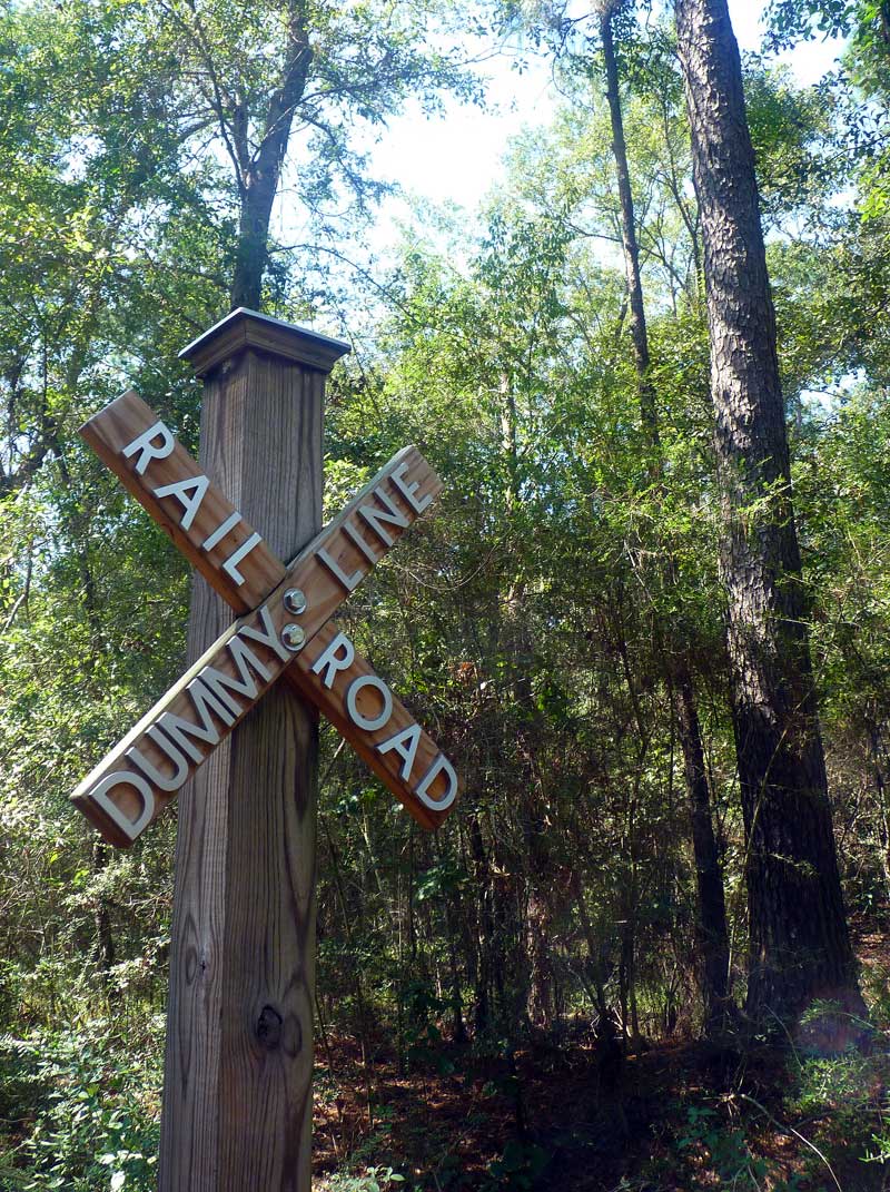
The Weston Lumber Company’s dummyline railroad connected Logtown, Pearlington, and scattered sawmills to the main line, and made it easy to ship lumber on land, instead of on the ships and barges used previously. When the sawmills closed in 1930, the rails, timbers, and rolling stock were salvaged and used elsewhere, or melted down as scrap during World War II.
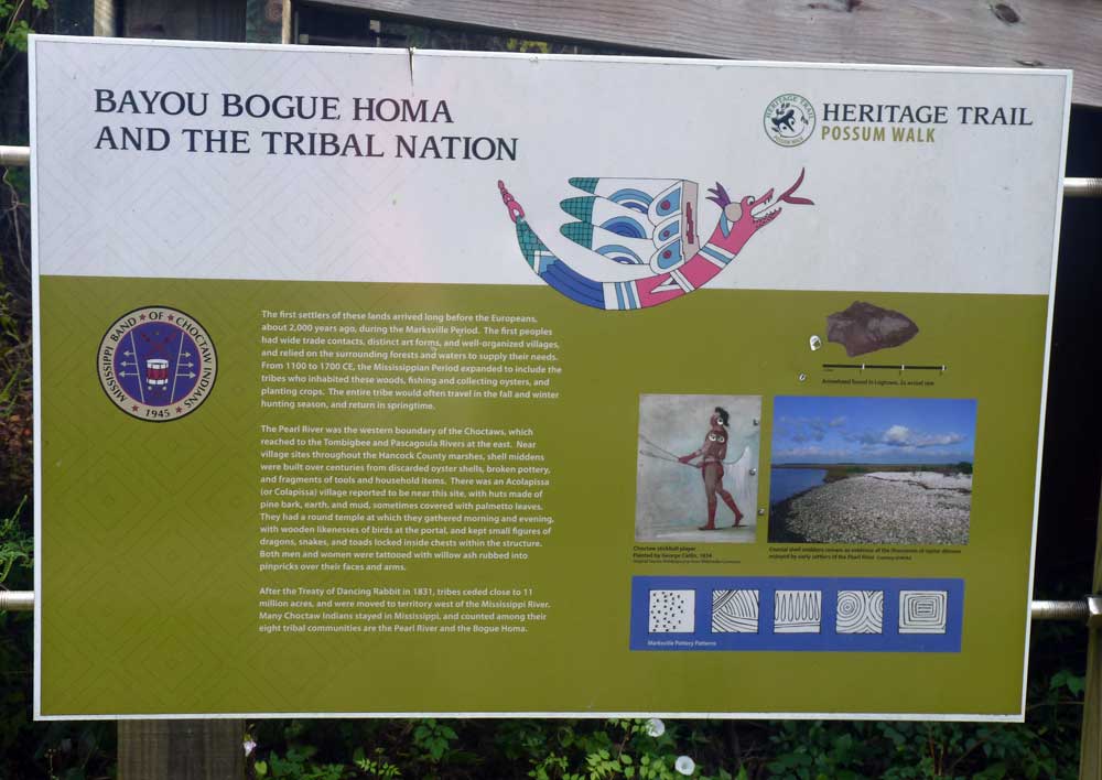
There are a number of interpretive signs along the trail with details on the history of the Logtown and Bayou Bogue Homa area.
Hiking the Trail, Day 2 We got off to a false start on Day 2. Upon arriving at Infinity Science Center to access the northern half of the trail we found the gates closed. New hours of operation for the facility limit access to the trail to Thursday through Sunday between the hours of 9 am and 4 pm. The following weekend we made good on our promise to finish the trail and made our way to INFINITY. We parked near the trail head and noticed the marked difference in the trail on this end. Where the trail blazed through mixed wetland vegetation near Logtown, on the north end the wide trail looked more like Highway 607, a stick-straight gravel path with wide grassy edges through pine woods. For the first 1/2-mile section there was little of interest, to us - or to any wildlife. 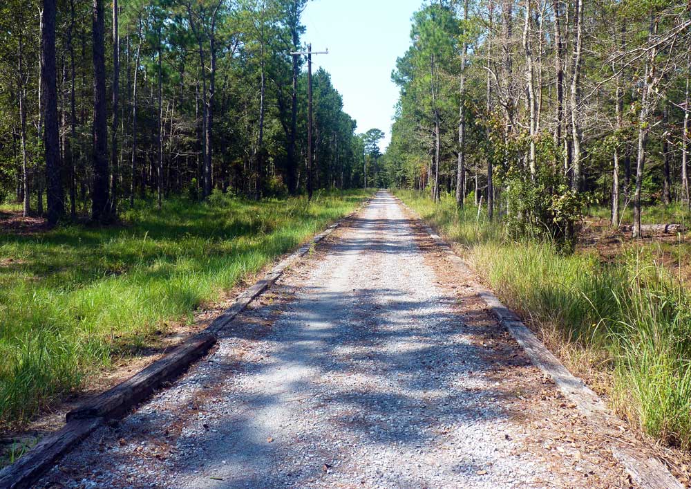
After the trail jogged 90 degrees to the left, however, it began to look more like the trail we’d walked the weekend before. While we were still walking through pine forest, understory plants took their rightful place in the habitat. After another turn in the trail we crossed a powerline cut, which provided just the change of habitat that birds like. Here we noted several hawks (they like to perch in the trees along powerline cuts and watch for prey), sparrows, and an Indigo Bunting passing through. Wildflowers and butterflies were still in abundance, offering plenty of opportunities for photography practice. While we didn’t enjoy anywhere near the diversity of wildlife we had seen the week before, an influx of birds kept us looking for something new. 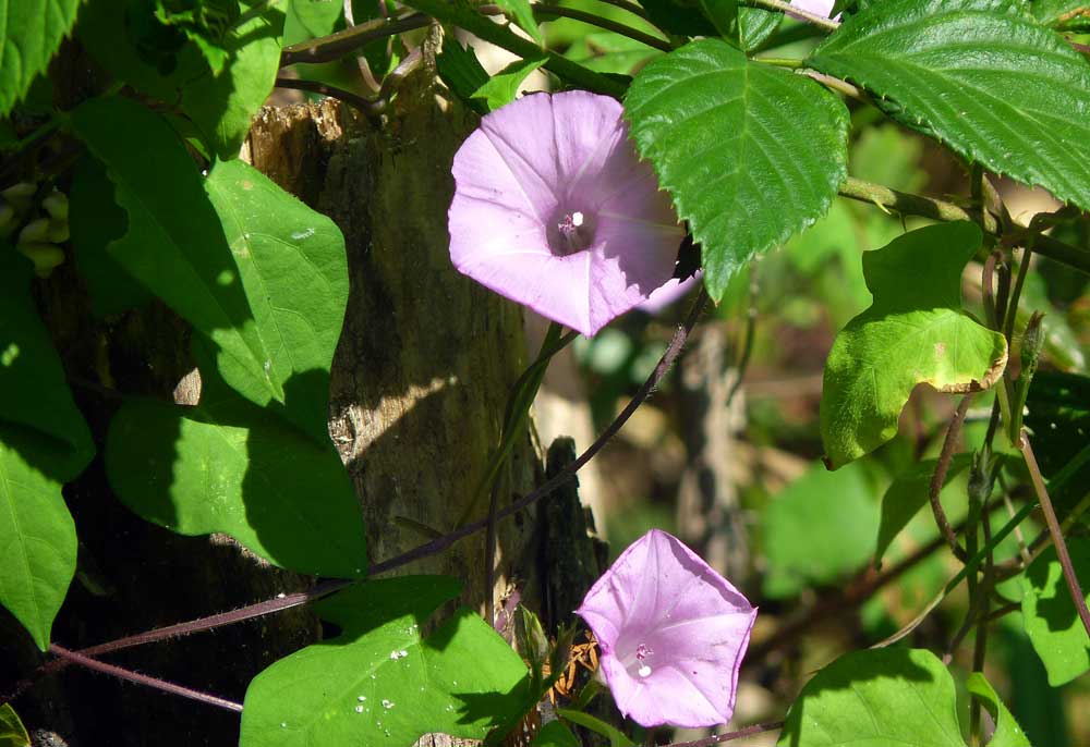
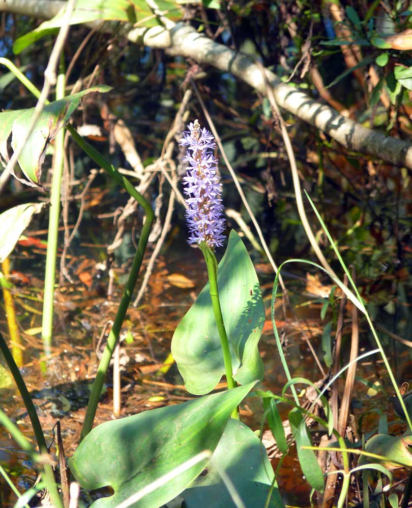
Pickerelweed, a common native (and beautiful) wetland plant.
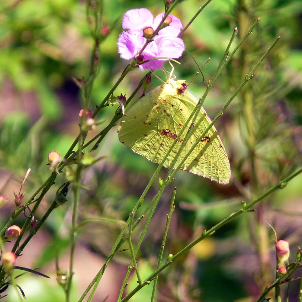
Cloudless Sulphur butterfly.
Once again we tapped the Mile 2.0 trail marker signaling our completion of the entire length of the trail, then headed back the way we came. Although we did not enjoy the northern half of the trail as much as the section that traversed through more wetlands habitat, we felt a sense of accomplishment in completing the entire 7.4 mile walk and vowed to visit again. We left on both days with a renewed energy and a glow in our cheeks. 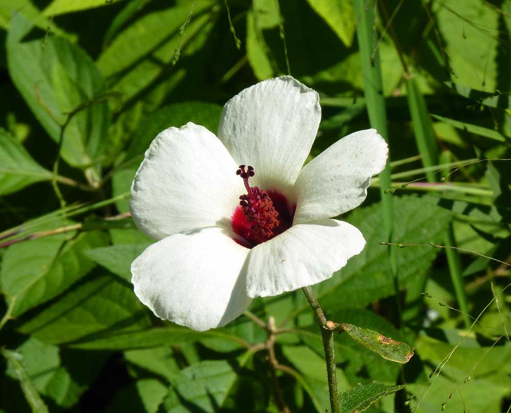
This exquisite flower is the native pineland hibiscus (Hibiscus aculeatus).
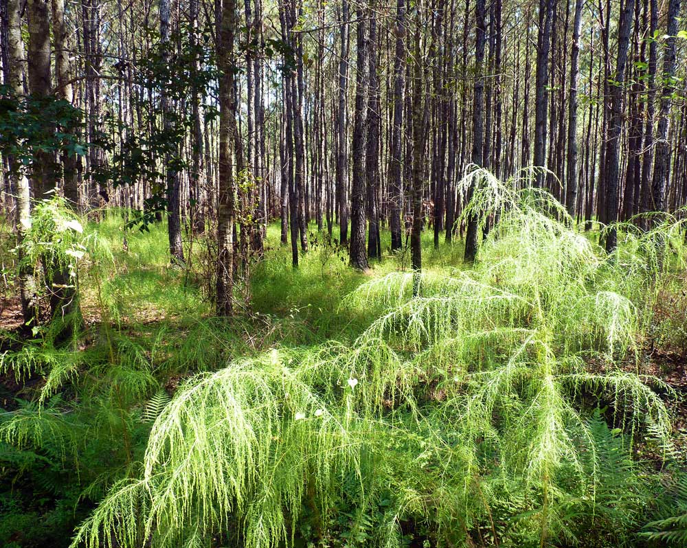
Controlled burns reduce the risk of wildfires and produce an ethereal landscape as new plants emerge from the forest floor.
A Few Tips
Comments are closed.
|


Categories
All
Archives
July 2024
|


 RSS Feed
Shoofly Magazine Partners
Our Shoofly Partners are local businesses and organizations who share our mission to enrich community life in Bay St. Louis, Waveland, Diamondhead and Pass Christian. These are limited in number to maximize visibility. Email us now to become a Shoofly Partner!
|
|

|
|
|
|
|

|
|

|
|
|

|
|
|
|
|

|
|
|
|
|
|
|
|
|

|
|
|
|

|